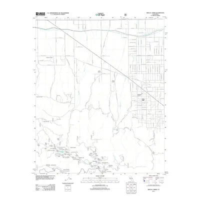
2012 Map of Mescal Creek
USGS Topo · Published 2012About this map
The Governor Edmund G Brown California Aqueduct cuts a distinctive horizontal path across the high desert floor, illustrating the massive scale of water infrastructure necessary for regional growth. To the south, the terrain rises sharply into a dense network of mountain camps and recreational sites including Sunrise Ski Area, Camp Junipero Serra, and Camp Verdugo Pines. The settlement of Piñon Hills occupies a transitional zone where a grid of residential streets like Joshua Hills Rd and Sierra Rd meets the alluvial fans of the San Gabriel range. Researchers will find a mix of scientific and recreational landmarks, from the high-altitude Smithsonian Observatory on Table Mountain to the waters of Jackson Lake. This 2012 survey captures the area's identity as both a high-desert residential community and a hub for institutional and youth camping organizations.
Find a feature on this map
79 named features on this map. Tap any name to fly to it.
Don’t see what you’re looking for? This feature index may not catch every label — zoom into the map to look around manually.
Map Details
Editions of this 2012 Mescal Creek Map
This is the sole edition of this map. No revisions or reprints were ever made.
Other maps of this area

1901 · Southern California Sheet No. 1
USGS Topo · 1:250,000

1903 · Rock Creek
USGS Topo · 1:62,500

1903 · San Antonio
USGS Topo · 1:62,500

1904 · Southern California Sheet No. 1
USGS Topo · 1:250,000

1930 · Black Butte
USGS Topo · 1:24,000

1930 · Angle
USGS Topo · 1:24,000

1932 · Angle
USGS Topo · 1:24,000

1933 · Black Butte
USGS Topo · 1:24,000

1934 · Mescal Creek
USGS Topo · 1:24,000
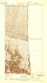
1934 · Boneyard Canyon
USGS Topo · 1:24,000