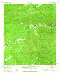
1950 Map of Mescalero
USGS Topo · Published 1963About this map
Mescalero Apache Indian Reservation land dominates this mid-century survey, centered on the communities and canyons of Otero County. The settlement of Mescalero serves as a focal point along the Rio Tularosa, where local history is anchored by the St Josephs Mission, the Mescalero Indian Cem, and the industrial site of Blazens Mill. Further west, the village of Bent is noted for the Bent Public Sch and nearby Ruins, illustrating the concentrated development along the primary canyon floors. The landscape is defined by a series of significant drainages including Tularosa Canyon and Nogal Canyon, which descend through the Lincoln National Forest. Smaller outposts such as Ranchario and the Geronimo Lodge reflect the area's mix of ranching, forest management, and early tourism, while an Aqueduct and various water tanks like Soldier Tank indicate the vital infrastructure required for life in the high New Mexico terrain.
Find a feature on this map
39 named features on this map. Tap any name to fly to it.
Don’t see what you’re looking for? This feature index may not catch every label — zoom into the map to look around manually.
Map Details
Editions of this 1950 Mescalero Map
2 editions found
Other maps of this area

1916 · Tularosa
USGS Topo · 1:125,000

1916 · Point Of Sands
USGS Topo · 1:125,000

1947 · Three Rivers
USGS Topo · 1:62,500

1948 · Tularosa
USGS Topo · 1:62,500

1948 · Holloman
USGS Topo · 1:62,500

1950 · Three Rivers
USGS Topo · 1:24,000

1950 · Alamogordo
USGS Topo · 1:62,500

1950 · Sierra Blanca Peak
USGS Topo · 1:62,500

1950 · Mescalero
USGS Topo · 1:62,500

1952 · Cloudcroft
USGS Topo · 1:62,500