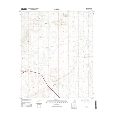
2013 Map of Mesita
USGS Topo · Published 2013About this map
Mesita and Laguna anchor this portion of the Laguna Pueblo lands, where the landscape is defined by the drainage of the Rio San Jose and its tributaries. The terrain transitions from the high, flat-topped N Oak Canyon Mesa and S Oak Canyon Mesa in the north to the valley floors where the Laguna Interchange marks a modern transportation corridor. Historically significant water management is evident at the Paguate Reservoir and along the Rio Paguate, supporting the settlements of Paguate and Marmon. The names on the land, such as Sunhouse Peaks, Heart Peak, and Yellow Hill, reflect a deep connection to the geography of Cibola County. These mesas and arroyos, including Arroyo Conchos and Arroyo Gigante, create a complex network of landforms that have dictated the placement of Indian Service Routes and established communities like Quirk.
Find a feature on this map
31 named features on this map. Tap any name to fly to it.
Don’t see what you’re looking for? This feature index may not catch every label — zoom into the map to look around manually.
Map Details
Editions of this 2013 Mesita Map
This is the sole edition of this map. No revisions or reprints were ever made.
Other maps of this area

1883 · Mt. Taylor
USGS Topo · 1:250,000

1886 · Mt. Taylor
USGS Topo · 1:250,000

1892 · Mt. Taylor
USGS Topo · 1:250,000

1899 · Mt. Taylor
USGS Topo · 1:250,000

1917 · Cerro Verde
USGS Topo · 1:125,000

1954 · Socorro
USGS Topo · 1:250,000

1956 · South Garcia
USGS Topo · 1:62,500

1957 · Laguna
USGS Topo · 1:24,000
1957 · Mesa Gigante
USGS Topo · 1:24,000

1957 · Moquino
USGS Topo · 1:24,000