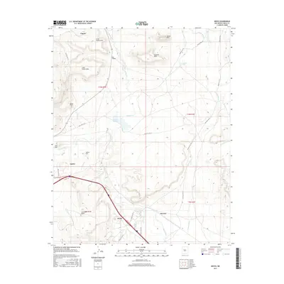
2017 Map of Mesita
USGS Topo · Published 2017About this map
Mesita and the surrounding Laguna Pueblo lands are defined by high mesas and seasonal watercourses in this recent survey. The settlement pattern follows the drainage of the Rio San Jose and Rio Paguate, with the Paguate Reservoir serving as a central hydrological feature. The landscape is dominated by distinct geological markers such as Sunhouse Peaks, Wiener Mesa, and Snowbird Mesa, which frame the tribal communities. An intricate network of service roads, including Indian SVC Rte 521 and Indian SVC Rte 52, connects the dispersed settlements of Paguate, Laguna, and Marmon. These routes trace the breaks between elevated features like N Oak Canyon Mesa and S Oak Canyon Mesa, illustrating how topography has historically dictated movement and habitation in this part of Cibola County.
Find a feature on this map
34 named features on this map. Tap any name to fly to it.
Don’t see what you’re looking for? This feature index may not catch every label — zoom into the map to look around manually.
Map Details
Editions of this 2017 Mesita Map
This is the sole edition of this map. No revisions or reprints were ever made.
Other maps of this area

1883 · Mt. Taylor
USGS Topo · 1:250,000

1886 · Mt. Taylor
USGS Topo · 1:250,000

1892 · Mt. Taylor
USGS Topo · 1:250,000

1899 · Mt. Taylor
USGS Topo · 1:250,000

1917 · Cerro Verde
USGS Topo · 1:125,000

1954 · Socorro
USGS Topo · 1:250,000

1956 · South Garcia
USGS Topo · 1:62,500

1957 · Laguna
USGS Topo · 1:24,000
1957 · Mesa Gigante
USGS Topo · 1:24,000

1957 · Moquino
USGS Topo · 1:24,000