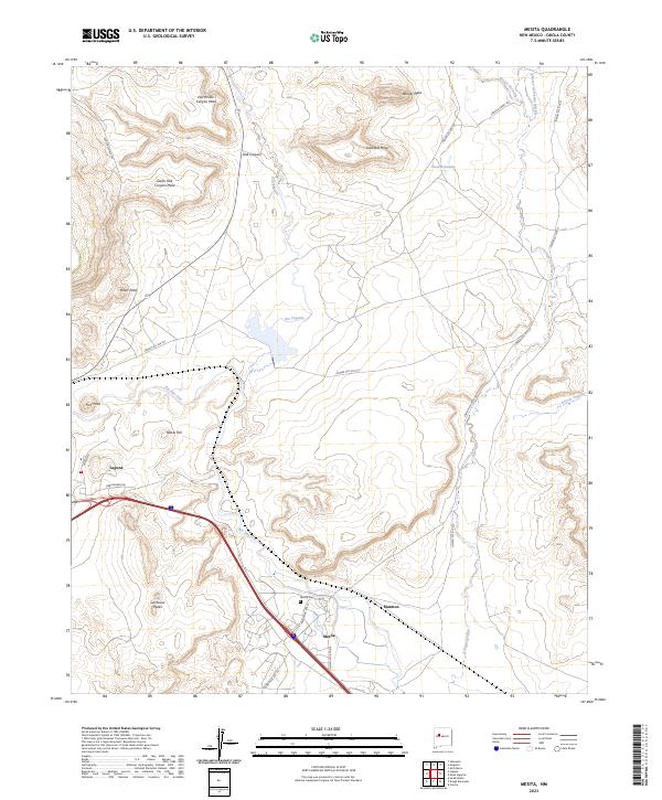
2023 Map of Mesita
USGS Topo · Published 2023About this map
Mesita and the neighboring settlements of Laguna and Marmon occupy a landscape defined by dramatic basalt mesas and winding waterways. The Rio San Jose and Rio Paguate converge in this territory, carving paths through a high-desert environment where topographic landmarks like Sunhouse Peaks and Heart Peak provide orientation. The map illustrates a complex network of Bureau of Indian Affairs routes, such as Indian Svc Rte 51 and Indian Svc Rte 522, which facilitate movement between the village centers and the outlying grazing lands.
Find a feature on this map
36 named features on this map. Tap any name to fly to it.
Don’t see what you’re looking for? This feature index may not catch every label — zoom into the map to look around manually.
Map Details
Editions of this 2023 Mesita Map
This is the sole edition of this map. No revisions or reprints were ever made.
Other maps of this area

1883 · Mt. Taylor
USGS Topo · 1:250,000

1886 · Mt. Taylor
USGS Topo · 1:250,000

1892 · Mt. Taylor
USGS Topo · 1:250,000

1899 · Mt. Taylor
USGS Topo · 1:250,000

1917 · Cerro Verde
USGS Topo · 1:125,000

1954 · Socorro
USGS Topo · 1:250,000

1956 · South Garcia
USGS Topo · 1:62,500

1957 · Laguna
USGS Topo · 1:24,000
1957 · Mesa Gigante
USGS Topo · 1:24,000

1957 · Moquino
USGS Topo · 1:24,000