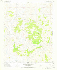
1961 Map of Mesita Del Gavilan
USGS Topo · Published 1978About this map
Rancho Rincon Marquez and the namesake Alfredo Padilla lands anchor this McKinley County ranching landscape as it appeared in the early 1960s. The terrain is defined by complex drainage systems such as the Arroyo Marquez and Arroyo Chico, with livestock management clearly visible through an extensive network of water catchments including Indian Pond, Stockade Tank, and Manted Cedar Tank.
Find a feature on this map
37 named features on this map. Tap any name to fly to it.
Don’t see what you’re looking for? This feature index may not catch every label — zoom into the map to look around manually.
Map Details
Editions of this 1961 Mesita Del Gavilan Map
3 editions found
Other maps of this area

1883 · Mt. Taylor
USGS Topo · 1:250,000

1886 · Mt. Taylor
USGS Topo · 1:250,000

1892 · Mt. Taylor
USGS Topo · 1:250,000

1899 · Mt. Taylor
USGS Topo · 1:250,000

1958 · Albuquerque
USGS Topo · 1:250,000

1961 · El Dado
USGS Topo · 1:24,000

1961 · Whitehorse Rincon
USGS Topo · 1:24,000

1961 · Cerro Parido
USGS Topo · 1:24,000

1961 · Mesita Del Gavilan
USGS Topo · 1:24,000
1961 · Mesita Americana
USGS Topo · 1:24,000