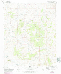
1961 Map of Mesita Del Gavilan
USGS Topo · Published 1989About this map
Rancho Rincon Marquez and the namesake Mesita del Gavilan define this high-desert landscape in McKinley County. The map details a cattle-ranching and water-management system crucial for the arid New Mexico environment, characterized by numerous named tanks and reservoirs like Martinez Tank, Echo Tank, and Amos Pit Reservoir. Water flow is dictated by the deep seasonal channels of Arroyo Marquez and Arroyo Chico, which cut through the mesa country. Evidence of earlier habitation or structures is noted at several Ruins locations, while a modern Pipeline traverses the northern reaches. The presence of features such as Alfredo Padilla and Stockade Tank suggests a landscape shaped by local land grants and the demands of livestock grazing in the mid-20th century.
Find a feature on this map
31 named features on this map. Tap any name to fly to it.
Don’t see what you’re looking for? This feature index may not catch every label — zoom into the map to look around manually.
Map Details
Editions of this 1961 Mesita Del Gavilan Map
3 editions found
Other maps of this area

1883 · Mt. Taylor
USGS Topo · 1:250,000

1886 · Mt. Taylor
USGS Topo · 1:250,000

1892 · Mt. Taylor
USGS Topo · 1:250,000

1899 · Mt. Taylor
USGS Topo · 1:250,000

1958 · Albuquerque
USGS Topo · 1:250,000

1961 · El Dado
USGS Topo · 1:24,000

1961 · Whitehorse Rincon
USGS Topo · 1:24,000

1961 · Cerro Parido
USGS Topo · 1:24,000

1961 · Mesita Del Gavilan
USGS Topo · 1:24,000
1961 · Mesita Americana
USGS Topo · 1:24,000