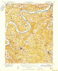
1950 Map of Meta
USGS Topo · Published 1950About this map
The Osage River carves a winding path through the borderlands of Cole, Osage, Miller, and Maries Counties, dictating the development of the mid-Missouri river hills during the mid-century. This survey captures a rural landscape where small river towns and agricultural centers like Westphalia and Meta are connected by a network of one-room schools and parish churches, such as St Margaret Ch and St Margaret Ch. The transition from river-based transport to rail is evident, with the Bodie Ferry (Aban'd) marked as out of use while the Chicago Rock Island and Pacific railroad cuts through the southern hills, passing through Tunnel No 2 and serving the community of Argyle. Geologic and local landmarks like Arch Cave and Painted Rock Lodge stand alongside family-named sites like Thompson Hill Sch, reflecting a deeply rooted local history.
Find a feature on this map
53 named features on this map. Tap any name to fly to it.
Don’t see what you’re looking for? This feature index may not catch every label — zoom into the map to look around manually.
Map Details
Editions of this 1950 Meta Map
This is the sole edition of this map. No revisions or reprints were ever made.
Other maps of this area

1886 · Jefferson City
USGS Topo · 1:125,000

1888 · Tuscumbia
USGS Topo · 1:125,000

1890 · Fulton
USGS Topo · 1:125,000

1894 · Tuscumbia
USGS Topo · 1:125,000

1894 · Jefferson City
USGS Topo · 1:125,000

1933 · Iberia
USGS Topo · 1:62,500

1934 · Linn
USGS Topo · 1:48,000

1937 · Iberia
USGS Topo · 1:62,500

1937 · Vienna
USGS Topo · 1:62,500

1938 · Vienna
USGS Topo · 1:48,000