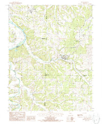
1987 Map of Meta
USGS Topo · Published 1988About this map
Meta serves as a focal point for this 1980s landscape, situated where the rolling hills of central Missouri meet the winding course of the Osage River. The map captures a transition in communication and infrastructure, noting the Meta Tower Site, a Lookout Tower, and a Radio Tower that mark the higher elevations. Settlement patterns are concentrated around the small village of St Thomas and the hamlet of Babbtown, while the riverbanks show numerous sand areas and a Gaging Sta reflecting the importance of the waterway.
Find a feature on this map
34 named features on this map. Tap any name to fly to it.
Don’t see what you’re looking for? This feature index may not catch every label — zoom into the map to look around manually.
Map Details
Editions of this 1987 Meta Map
This is the sole edition of this map. No revisions or reprints were ever made.
Other maps of this area

1888 · Tuscumbia
USGS Topo · 1:125,000

1894 · Tuscumbia
USGS Topo · 1:125,000

1933 · Iberia
USGS Topo · 1:62,500

1937 · Iberia
USGS Topo · 1:62,500

1947 · Jefferson City
USGS Topo · 1:250,000

1948 · Meta
USGS Topo · 1:62,500
1948 · Eugene
USGS Topo · 1:62,500

1948 · Tavern
USGS Topo · 1:62,500
1950 · Meta
USGS Topo · 1:62,500
1950 · Tavern
USGS Topo · 1:62,500