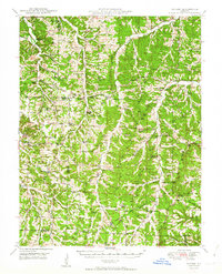
1950 Map of Tavern
USGS Topo · Published 1950About this map
Maries River and Tavern Creek carve through this central Missouri landscape, defining a rural network of small settlements and educational outposts at the midpoint of the century. The terrain is characterized by winding watercourses like Little Maries River and Dry Creek, with prominent landmarks such as the Big Bend and Flat Top Hill. An underground pipe line cuts across the southern portion of the sheet, signaling post-war infrastructural expansion through the countryside.
Find a feature on this map
60 named features on this map. Tap any name to fly to it.
Don’t see what you’re looking for? This feature index may not catch every label — zoom into the map to look around manually.
Map Details
Editions of this 1950 Tavern Map
3 editions found
Other maps of this area

1888 · Tuscumbia
USGS Topo · 1:125,000

1894 · Tuscumbia
USGS Topo · 1:125,000

1912 · Rolla
USGS Topo · 1:62,500

1933 · Iberia
USGS Topo · 1:62,500

1934 · Linn
USGS Topo · 1:48,000

1936 · Waynesville
USGS Topo · 1:48,000

1937 · Iberia
USGS Topo · 1:62,500

1937 · Vienna
USGS Topo · 1:62,500

1938 · Vienna
USGS Topo · 1:48,000

1942 · Waynesville
USGS Topo · 1:62,500