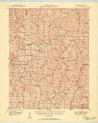
1950 Map of Tavern
USGS Topo · Published 1950About this map
The Maries River and Tavern Creek define the landscape of southern Maries County in the late 1940s, carving paths through the central Missouri hills. This rural domain is characterized by small, scattered settlements like Brinktown, Tavern, and Van Cleve, which serve as the anchors for a web of country schools and churches. An Underground Pipe Line cuts across the terrain, representing a modern industrial layer atop an area otherwise dominated by topography and traditional land use.
Find a feature on this map
79 named features on this map. Tap any name to fly to it.
Don’t see what you’re looking for? This feature index may not catch every label — zoom into the map to look around manually.
Map Details
Editions of this 1950 Tavern Map
3 editions found
Other maps of this area

1888 · Tuscumbia
USGS Topo · 1:125,000

1894 · Tuscumbia
USGS Topo · 1:125,000

1912 · Rolla
USGS Topo · 1:62,500

1933 · Iberia
USGS Topo · 1:62,500

1934 · Linn
USGS Topo · 1:48,000

1936 · Waynesville
USGS Topo · 1:48,000

1937 · Iberia
USGS Topo · 1:62,500

1937 · Vienna
USGS Topo · 1:62,500

1938 · Vienna
USGS Topo · 1:48,000

1942 · Waynesville
USGS Topo · 1:62,500