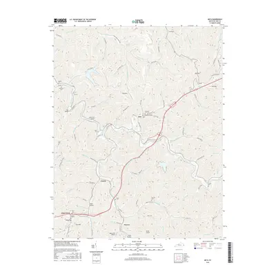
2016 Map of Meta
USGS Topo · Published 2016About this map
Pikeville anchoring the southwest corner, the landscape rises into the ridges and hollows characteristic of Pike County. The winding course of Johns Creek and its many tributaries, such as Bevins Branch and Scott Fork, dictates the settlement patterns and roadway routes through the area. Local history and genealogy are deeply embedded in the terrain, evidenced by numerous family-named landmarks and burial sites including Chestnut Point Cem, Morris Cem, and Lawson Cem. Smaller communities like Meta, Zebulon, and Raccoon are connected by a network of hollow-tracing roads such as Knob Fork Rd and Thompson Branch Rd. The topography is marked by distinctive elevations like Ford Mtn and Town Mtn, while the proximity of the CSX RR near Howard Cem reflects the region's long-standing connection to the coal and rail industries.
Find a feature on this map
107 named features on this map. Tap any name to fly to it.
Don’t see what you’re looking for? This feature index may not catch every label — zoom into the map to look around manually.
Map Details
Editions of this 2016 Meta Map
This is the sole edition of this map. No revisions or reprints were ever made.
Other maps of this area

1886 · Prestonsburg
USGS Topo · 1:125,000

1886 · Grundy
USGS Topo · 1:125,000

1887 · Warfield
USGS Topo · 1:125,000

1890 · Whitesburg
USGS Topo · 1:125,000

1890 · Grundy
USGS Topo · 1:125,000

1891 · Warfield
USGS Topo · 1:125,000

1892 · Grundy
USGS Topo · 1:125,000

1892 · Whitesburg
USGS Topo · 1:125,000

1892 · Prestonsburg
USGS Topo · 1:125,000

1914 · Laynesville
USGS Topo · 1:48,000