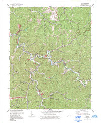
1992 Map of Meta
USGS Topo · Published 1992About this map
Johns Creek meanders through the heart of this Appalachian landscape, defining the local geography around Meta and Zebulon in the early 1990s. The map illustrates a community deeply integrated with its drainage basins, where nearly every hollow is named for a specific branch or fork, such as Pigeonroost Branch, Bevins Branch, and Hollybush Branch. This intricate network of watercourses dictated the placement of early settlements and transportation routes like KY 194.
Find a feature on this map
34 named features on this map. Tap any name to fly to it.
Don’t see what you’re looking for? This feature index may not catch every label — zoom into the map to look around manually.
Map Details
Editions of this 1992 Meta Map
This is the sole edition of this map. No revisions or reprints were ever made.
Other maps of this area

1886 · Prestonsburg
USGS Topo · 1:125,000

1886 · Grundy
USGS Topo · 1:125,000

1887 · Warfield
USGS Topo · 1:125,000

1890 · Whitesburg
USGS Topo · 1:125,000

1890 · Grundy
USGS Topo · 1:125,000

1891 · Warfield
USGS Topo · 1:125,000

1892 · Grundy
USGS Topo · 1:125,000

1892 · Whitesburg
USGS Topo · 1:125,000

1892 · Prestonsburg
USGS Topo · 1:125,000

1914 · Laynesville
USGS Topo · 1:48,000