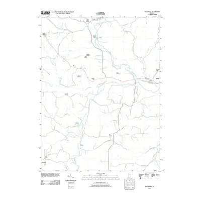
2010 Map of Metamora
USGS Topo · Published 2010About this map
The Whitewater River corridor defines the landscape of this Franklin County region, where the town of Metamora and the neighboring village of Laurel represent historic hubs of commerce along the waterway. The area is marked by significant cultural landmarks, most notably the Wiley Indian Mound and the Laurel Feeder Dam, which point to the ancient and industrial history of the valley. For those researching local family history, the map provides precise locations for numerous burial grounds, including the Stipps Hill Cemetery, Jenks Cemetery, and the Saint Nicholas Cemetery near Peppertown. The terrain transitions from the river flats to elevated points like Jackson Hill and McGuire Ridge, with numerous named hollows and creek branches like Sillimans Creek and Whistle Creek cutting through the countryside. This document preserves the late-modern arrangement of small Indiana settlements and rural farm roads before recent decade developments.
Find a feature on this map
83 named features on this map. Tap any name to fly to it.
Don’t see what you’re looking for? This feature index may not catch every label — zoom into the map to look around manually.
Map Details
Editions of this 2010 Metamora Map
This is the sole edition of this map. No revisions or reprints were ever made.
Other maps of this area

1946 · Batesville
USGS Topo · 1:24,000

1946 · New Point
USGS Topo · 1:24,000

1953 · Cincinnati
USGS Topo · 1:250,000

1956 · Everton
USGS Topo · 1:24,000

1956 · Alpine
USGS Topo · 1:24,000

1956 · Metamora
USGS Topo · 1:24,000

1956 · Brookville
USGS Topo · 1:24,000

1957 · Cincinnati
USGS Topo · 1:250,000

1958 · Spades
USGS Topo · 1:24,000

1958 · Clarksburg
USGS Topo · 1:24,000