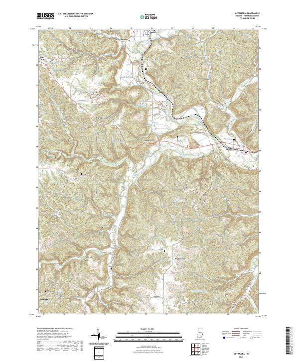
2022 Map of Metamora
USGS Topo · Published 2022About this map
The Whitewater River valley and its historic transportation corridors define this portion of Franklin County, where the town of Metamora serves as a focal point. The landscape is marked by the preservation of the Whitewater Canal, which runs parallel to the river and indicates the region's 19th-century commercial roots. To the north, the settlement of Laurel sits near the Wiley Indian Mound, while smaller crossroads like Peppertown and Hamburg anchor the southern reaches. Numerous small family and church burial grounds, such as Jenks Cem, Gobel Cem, and Marlin Cem, are scattered across the dissected plateau, providing essential data for genealogical research. The terrain is further shaped by drainage systems like Salt Creek and Duck Creek, which have carved deep valleys and hollows, including Coalpit Hollow and Hollis Hollow, creating a complex network of ridges such as McGuire Ridge.
Find a feature on this map
103 named features on this map. Tap any name to fly to it.
Don’t see what you’re looking for? This feature index may not catch every label — zoom into the map to look around manually.
Map Details
Editions of this 2022 Metamora Map
This is the sole edition of this map. No revisions or reprints were ever made.
Other maps of this area

1946 · Batesville
USGS Topo · 1:24,000

1946 · New Point
USGS Topo · 1:24,000

1953 · Cincinnati
USGS Topo · 1:250,000

1956 · Everton
USGS Topo · 1:24,000

1956 · Alpine
USGS Topo · 1:24,000

1956 · Metamora
USGS Topo · 1:24,000

1956 · Brookville
USGS Topo · 1:24,000

1957 · Cincinnati
USGS Topo · 1:250,000

1958 · Spades
USGS Topo · 1:24,000

1958 · Clarksburg
USGS Topo · 1:24,000