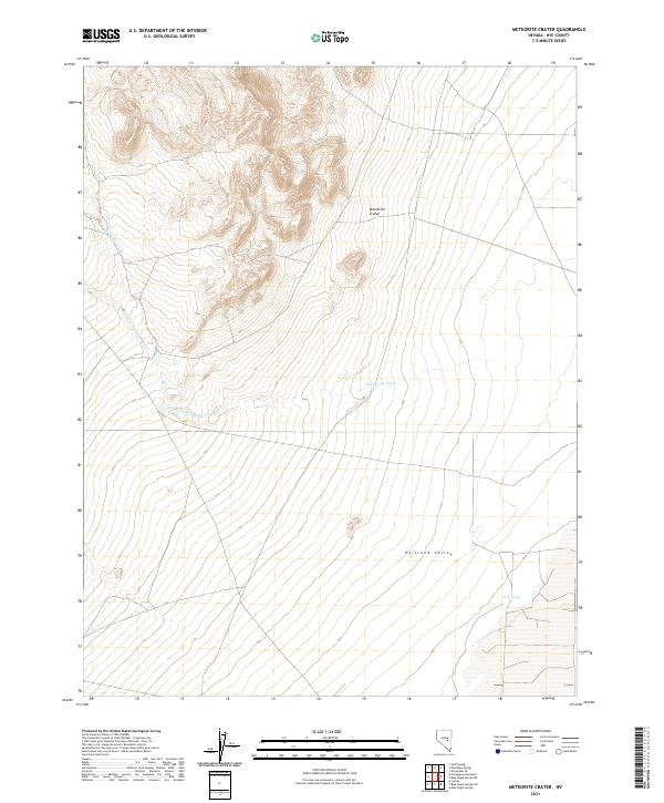
2021 Map of Meteorite Crater
USGS Topo · Published 2021About this map
Meteorite Crater sits as the central geographic landmark of this high-desert landscape in Nye County. The terrain is defined by the broad expanse of Railroad Valley, an area characterized by its intricate drainage patterns and sparse water sources. Seasonally active watercourses like Ike Spring Wash and Little Ike Spring Wash carve through the alluvial fans at the base of the mountains, illustrating the hydrologic movement through this arid basin. A notable outlier in the southern reaches is Trap Spring, a vital point of interest in a region where surface water is otherwise limited to transient washes. This 2021 survey by the U.S. Geological Survey captures the modern topographic state of these geological features, offering a precise look at the land's contours and the intersection of the township and range survey lines.
Find a feature on this map
11 named features on this map. Tap any name to fly to it.
Don’t see what you’re looking for? This feature index may not catch every label — zoom into the map to look around manually.
Map Details
Editions of this 2021 Meteorite Crater Map
This is the sole edition of this map. No revisions or reprints were ever made.
Other maps of this area

1956 · Lund
USGS Topo · 1:250,000

1960 · Lund
USGS Topo · 1:250,000

1964 · Blue Eagle Springs
USGS Topo · 1:62,500

1964 · Duckwater
USGS Topo · 1:62,500

1968 · Portuguese Mtn
USGS Topo · 1:62,500
1968 · Sand Spring
USGS Topo · 1:24,000

1968 · Portuguese Mtn
USGS Topo · 1:24,000
1968 · Lockes
USGS Topo · 1:24,000

1980 · Duckwater
USGS Topo · 1:100,000
1990 · Bradshaw Spring
USGS Topo · 1:24,000