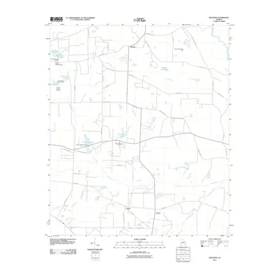
2011 Map of Methvins
USGS Topo · Published 2011About this map
Lamar and Methvins anchor this agrarian landscape in Sumter County, where the topography is defined by the winding course of Lime Creek and its many tributaries. The area is heavily managed for water, evidenced by a series of significant local impoundments and dams, including Browns Millpond, Pat Crumpton Lake, and the twin basins of Hoke Smith Lake West and East. These water features, alongside Floyd Frazier Lake, speak to the region's long-standing reliance on local creek systems like Hurricane Branch and Murray Branch for agricultural and recreational purposes.
Find a feature on this map
51 named features on this map. Tap any name to fly to it.
Don’t see what you’re looking for? This feature index may not catch every label — zoom into the map to look around manually.
Map Details
Editions of this 2011 Methvins Map
This is the sole edition of this map. No revisions or reprints were ever made.
Other maps of this area

1953 · Dothan
USGS Topo · 1:250,000

1953 · Waycross
USGS Topo · 1:250,000

1954 · Dothan
USGS Topo · 1:250,000

1955 · Dothan
USGS Topo · 1:250,000

1955 · Phenix City
USGS Topo · 1:250,000

1956 · Leslie
USGS Topo · 1:62,500

1957 · Phenix City
USGS Topo · 1:250,000

1957 · Macon
USGS Topo · 1:250,000

1958 · Macon
USGS Topo · 1:250,000

1958 · Phenix City
USGS Topo · 1:250,000