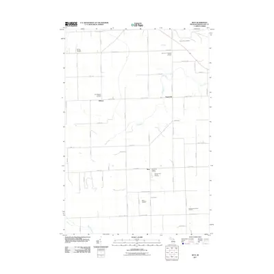
2011 Map of Metz
USGS Topo · Published 2011About this map
Belknap, Metz, and Hagensville form the heart of this Presque Isle County landscape, where the road network follows a rigid section-line grid typical of Michigan's agricultural townships. The area is defined by a dense concentration of religious and community burial sites, many reflecting the heritage of the early settlers. Among these are the Saint Michael's Lutheran Cemetery near Belknap and the New German Lutheran Cemetery and Saint Dominic's Catholic Cemetery situated just outside of Metz.
Find a feature on this map
63 named features on this map. Tap any name to fly to it.
Don’t see what you’re looking for? This feature index may not catch every label — zoom into the map to look around manually.
Map Details
Editions of this 2011 Metz Map
This is the sole edition of this map. No revisions or reprints were ever made.
Other maps of this area

1954 · Alpena
USGS Topo · 1:250,000

1955 · Hillman
USGS Topo · 1:62,500

1957 · Alpena
USGS Topo · 1:250,000

1958 · Alpena
USGS Topo · 1:250,000

1969 · Alpena
USGS Topo · 1:250,000

1971 · Rogers City
USGS Topo · 1:24,000

1971 · Hawks
USGS Topo · 1:24,000

1971 · Metz
USGS Topo · 1:24,000
1971 · Moltke
USGS Topo · 1:24,000
1971 · Adams Point
USGS Topo · 1:24,000