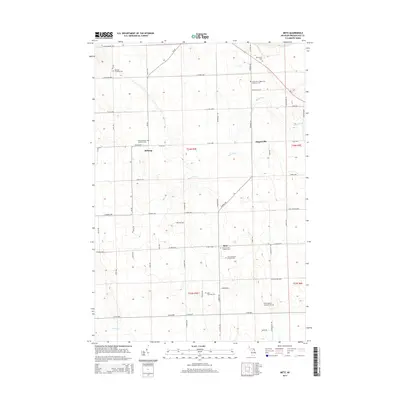
2014 Map of Metz
USGS Topo · Published 2014About this map
Metz and the surrounding townships in Presque Isle County serve as a study of a quiet agrarian landscape defined by its community landmarks. The topography is shaped by the winding Swan River and several smaller tributaries like Quinn Cr. This area is particularly dense with historic burial grounds, reflecting the deep-rooted heritage of the local population. Genealogists will find a wealth of specific locations including the Metz Township Cem, Saint John's Hagenville Lutheran Cem, and Mt Calvary Cem. The layout of the region is structured around a network of early roads named for local families and townships, such as Wirgau Rd and Haske Rd. While the settlements of Belknap and Hagensville remain central points of reference, the map emphasizes the continuity of these rural communities through the 21st century.
Find a feature on this map
59 named features on this map. Tap any name to fly to it.
Don’t see what you’re looking for? This feature index may not catch every label — zoom into the map to look around manually.
Map Details
Editions of this 2014 Metz Map
This is the sole edition of this map. No revisions or reprints were ever made.
Other maps of this area

1954 · Alpena
USGS Topo · 1:250,000

1955 · Hillman
USGS Topo · 1:62,500

1957 · Alpena
USGS Topo · 1:250,000

1958 · Alpena
USGS Topo · 1:250,000

1969 · Alpena
USGS Topo · 1:250,000

1971 · Rogers City
USGS Topo · 1:24,000

1971 · Hawks
USGS Topo · 1:24,000

1971 · Metz
USGS Topo · 1:24,000
1971 · Moltke
USGS Topo · 1:24,000
1971 · Adams Point
USGS Topo · 1:24,000