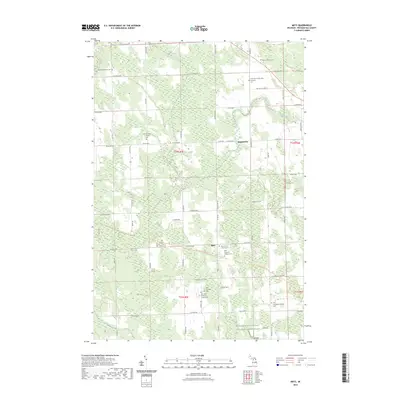
2023 Map of Metz
USGS Topo · Published 2023About this map
Metz and Hagensville anchor this Presque Isle County landscape, where the legacy of early 20th-century settlement is clearly visible through a dense concentration of local cemeteries and churches. The map highlights the spiritual and community history of the region, specifically marking the New German Lutheran Cem and Saint Dominic's Catholic Cem. These sites, along with the Old Saint Dominic's Catholic Cem and Old Evangelist Lutheran Cem, suggest a history of shifting parish locations or congregational growth over the decades.
Find a feature on this map
49 named features on this map. Tap any name to fly to it.
Don’t see what you’re looking for? This feature index may not catch every label — zoom into the map to look around manually.
Map Details
Editions of this 2023 Metz Map
This is the sole edition of this map. No revisions or reprints were ever made.
Other maps of this area

1954 · Alpena
USGS Topo · 1:250,000

1955 · Hillman
USGS Topo · 1:62,500

1957 · Alpena
USGS Topo · 1:250,000

1958 · Alpena
USGS Topo · 1:250,000

1969 · Alpena
USGS Topo · 1:250,000

1971 · Rogers City
USGS Topo · 1:24,000

1971 · Hawks
USGS Topo · 1:24,000

1971 · Metz
USGS Topo · 1:24,000
1971 · Moltke
USGS Topo · 1:24,000
1971 · Adams Point
USGS Topo · 1:24,000