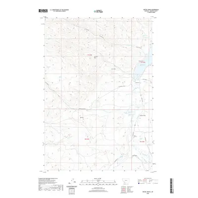
2020 Map of Metzel Ranch
USGS Topo · Published 2020About this map
Ruby River Reservoir dominates the eastern drainage of this Madison County landscape, where the Ruby River flows through a complex network of ranching and irrigation infrastructure. The presence of Pioneer Ditch and numerous springs, including the distinctive Puller Hot Springs, highlights the historical importance of water management in this high-basin environment. Cultural and geological history intersect at the Buffalo Jumps near the riverbank, a site reflecting indigenous land use that predates the established ranching boundaries of the Metzel Ranch.
Find a feature on this map
48 named features on this map. Tap any name to fly to it.
Don’t see what you’re looking for? This feature index may not catch every label — zoom into the map to look around manually.
Map Details
Editions of this 2020 Metzel Ranch Map
This is the sole edition of this map. No revisions or reprints were ever made.
Other maps of this area

1893 · Dillon
USGS Topo · 1:250,000

1955 · Dillon
USGS Topo · 1:250,000

1957 · Dillon
USGS Topo · 1:250,000

1958 · Dillon
USGS Topo · 1:250,000

1961 · Mine Gulch
USGS Topo · 1:24,000

1961 · Red Canyon
USGS Topo · 1:24,000

1961 · Beaverhead Rock SE
USGS Topo · 1:24,000

1962 · Dillon
USGS Topo · 1:250,000
1963 · Metzel Ranch
USGS Topo · 1:24,000
1963 · Home Park Ranch
USGS Topo · 1:24,000