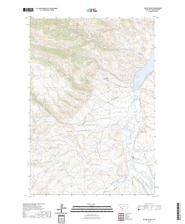
2024 Map of Metzel Ranch
USGS Topo · Published 2024About this map
Ruby River waters dominate the eastern edge of this Madison County landscape, where the Ruby River Reservoir transitions into a network of managed water systems like the Pioneer Ditch and Leyendecker Powers Ditch. The terrain is defined by the high elevations of the Ruby Range and Table Mtn, creating a complex series of drainage basins including Antelope Basin and Fossil Basin. These natural features are interspersed with evidence of early and ongoing land use, from the Upper Ruby Cem near the riverbanks to the archaeological significance of the Buffalo Jumps overlooking the valley. A multitude of thermal and freshwater sources, such as the Puller Hot Spring Springs and Warm Springs, punctuate the foothills, highlighting the region's active geology. The road network, including Garden Creek Rd and Sweetwater Rd, follows the natural contours of the gulches and creeks that feed into the central valley.
Find a feature on this map
47 named features on this map. Tap any name to fly to it.
Don’t see what you’re looking for? This feature index may not catch every label — zoom into the map to look around manually.
Map Details
Editions of this 2024 Metzel Ranch Map
This is the sole edition of this map. No revisions or reprints were ever made.
Other maps of this area

1893 · Dillon
USGS Topo · 1:250,000

1955 · Dillon
USGS Topo · 1:250,000

1957 · Dillon
USGS Topo · 1:250,000

1958 · Dillon
USGS Topo · 1:250,000

1961 · Mine Gulch
USGS Topo · 1:24,000

1961 · Red Canyon
USGS Topo · 1:24,000

1961 · Beaverhead Rock SE
USGS Topo · 1:24,000

1962 · Dillon
USGS Topo · 1:250,000
1963 · Metzel Ranch
USGS Topo · 1:24,000
1963 · Home Park Ranch
USGS Topo · 1:24,000