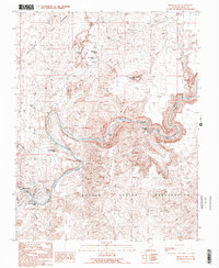
1989 Map of Mexican Hat
USGS Topo · Published 1989About this map
Mexican Hat and its surrounding desert landscape are defined by the winding course of the San Juan River, which carves through the San Juan Canyon and creates a natural boundary for the northern reaches of the Navajo Indian Reservation. This late-1980s data illustrates a region of dramatic geologic relief, where the Valley of the Gods and the distinctive Mexican Hat Rock serve as landmarks for travelers and locals alike.
Find a feature on this map
26 named features on this map. Tap any name to fly to it.
Don’t see what you’re looking for? This feature index may not catch every label — zoom into the map to look around manually.
Map Details
Editions of this 1989 Mexican Hat Map
2 editions found
Other maps of this area

1886 · Abajo
USGS Topo · 1:250,000

1892 · Abajo
USGS Topo · 1:250,000

1893 · Abajo
USGS Topo · 1:250,000

1952 · Bluff 3 SE
USGS Topo · 1:24,000
1952 · Bluff 3 SW
USGS Topo · 1:24,000

1956 · Cortez
USGS Topo · 1:250,000

1958 · Cortez
USGS Topo · 1:250,000

1959 · Cortez
USGS Topo · 1:250,000

1962 · Cortez
USGS Topo · 1:250,000

1962 · Bluff
USGS Topo · 1:62,500