
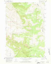
1960 Map of Mexican Hill
USGS Topo · Published 1962About this map
Bighorn National Forest dominates this landscape along the county line between Big Horn and Sheridan Counties. The terrain is defined by dramatic elevation changes, notably within the steep descent of Devils Canyon and the surrounding peaks of Sheep Mountain and Mexican Hill. In this high-elevation wilderness, water sources like Railroad Springs and Trout Creek feed into a network of drainages including Big Tepee Creek and Little Tepee Creek.
Find a feature on this map
20 named features on this map. Tap any name to fly to it.
Don’t see what you’re looking for? This feature index may not catch every label — zoom into the map to look around manually.
Map Details
Editions of this 1960 Mexican Hill Map
2 editions found
Other maps of this area

1894 · St. Xavier
USGS Topo · 1:125,000

1898 · Bald Mountain
USGS Topo · 1:125,000

1901 · St. Xavier
USGS Topo · 1:125,000

1901 · Bald Mountain
USGS Topo · 1:125,000

1954 · Billings
USGS Topo · 1:250,000

1954 · Hardin
USGS Topo · 1:250,000

1955 · Cody
USGS Topo · 1:250,000

1955 · Sheridan
USGS Topo · 1:250,000

1957 · Hardin
USGS Topo · 1:250,000

1957 · Billings
USGS Topo · 1:250,000