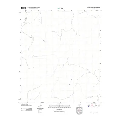
2010 Map of Meyers Canyon NW
USGS Topo · Published 2010About this map
Big Canyon dominates this West Texas landscape, winding through a remote section of Terrell County as recorded in this 2010 survey. The map reveals the intricate drainage patterns and sharp elevation changes characteristic of this arid region. Human presence is sparse, defined primarily by ranch roads and property boundaries that cut across the high desert terrain. Local transportation is limited to routes like Chriesman Rd and Hutchinson Rd, which traverse the southeastern corner of the quadrangle. These roads provide rare access points to the vast, undeveloped stretches of the canyon system, illustrating the isolation and specialized land use common in this part of the state at the start of the twenty-first century.
Find a feature on this map
3 named features on this map. Tap any name to fly to it.
Don’t see what you’re looking for? This feature index may not catch every label — zoom into the map to look around manually.
Map Details
Editions of this 2010 Meyers Canyon NW Map
This is the sole edition of this map. No revisions or reprints were ever made.
Other maps of this area

1928 · Sanderson
USGS Topo · 1:125,000

1954 · Fort Stockton
USGS Topo · 1:250,000

1954 · Sonora
USGS Topo · 1:250,000

1958 · Sonora
USGS Topo · 1:250,000

1958 · Fort Stockton
USGS Topo · 1:250,000

1968 · Dryden
USGS Topo · 1:24,000

1969 · Continental Ranch
USGS Topo · 1:24,000

1969 · Dryden NE
USGS Topo · 1:24,000

1973 · Fort Stockton
USGS Topo · 1:250,000
1980 · Geddis Canyon East
USGS Topo · 1:24,000