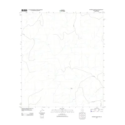
2012 Map of Meyers Canyon NW
USGS Topo · Published 2012About this map
Big Canyon dominates this arid landscape in Terrell County, showing a complex drainage network characteristic of the Trans-Pecos region. In 2012, this portion of West Texas remained sparsely developed, defined primarily by a handful of remote thoroughfares that cross the rugged desert terrain. Local transportation is represented by routes such as Stavley Rd in the west and Bailey Rd descending from the north. These named roads provide access through a landscape shaped by intermittent watercourses and deep canyon systems. Near the southeast corner, the intersection of Chriesman Rd and Hutchinson Rd marks one of the few points of human transit in an area defined more by its physical geography than by concentrated settlement.
Find a feature on this map
5 named features on this map. Tap any name to fly to it.
Don’t see what you’re looking for? This feature index may not catch every label — zoom into the map to look around manually.
Map Details
Editions of this 2012 Meyers Canyon NW Map
This is the sole edition of this map. No revisions or reprints were ever made.
Other maps of this area

1928 · Sanderson
USGS Topo · 1:125,000

1954 · Fort Stockton
USGS Topo · 1:250,000

1954 · Sonora
USGS Topo · 1:250,000

1958 · Sonora
USGS Topo · 1:250,000

1958 · Fort Stockton
USGS Topo · 1:250,000

1968 · Dryden
USGS Topo · 1:24,000

1969 · Continental Ranch
USGS Topo · 1:24,000

1969 · Dryden NE
USGS Topo · 1:24,000

1973 · Fort Stockton
USGS Topo · 1:250,000
1980 · Geddis Canyon East
USGS Topo · 1:24,000