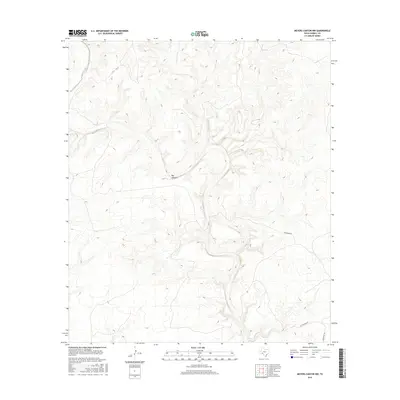
2016 Map of Meyers Canyon NW
USGS Topo · Published 2016About this map
Big Canyon defines the drainage pattern of this landscape in the western reaches of Terrell County, where deep incisions and high mesas characterize the terrain. This 2016 survey illustrates a largely unpopulated portion of West Texas where the environment dictates the human footprint. Transportation is limited to remote corridors such as Chriesman Rd and Hutchinson Rd, which follow the natural contours of the high ground between canyon systems. The map provides a detailed record of the physical geography, showing the complex network of draws and ridges that feed into the larger canyon network, essential data for land management and geological study in this arid region.
Find a feature on this map
3 named features on this map. Tap any name to fly to it.
Don’t see what you’re looking for? This feature index may not catch every label — zoom into the map to look around manually.
Map Details
Editions of this 2016 Meyers Canyon NW Map
This is the sole edition of this map. No revisions or reprints were ever made.
Other maps of this area

1928 · Sanderson
USGS Topo · 1:125,000

1954 · Fort Stockton
USGS Topo · 1:250,000

1954 · Sonora
USGS Topo · 1:250,000

1958 · Sonora
USGS Topo · 1:250,000

1958 · Fort Stockton
USGS Topo · 1:250,000

1968 · Dryden
USGS Topo · 1:24,000

1969 · Continental Ranch
USGS Topo · 1:24,000

1969 · Dryden NE
USGS Topo · 1:24,000

1973 · Fort Stockton
USGS Topo · 1:250,000
1980 · Geddis Canyon East
USGS Topo · 1:24,000