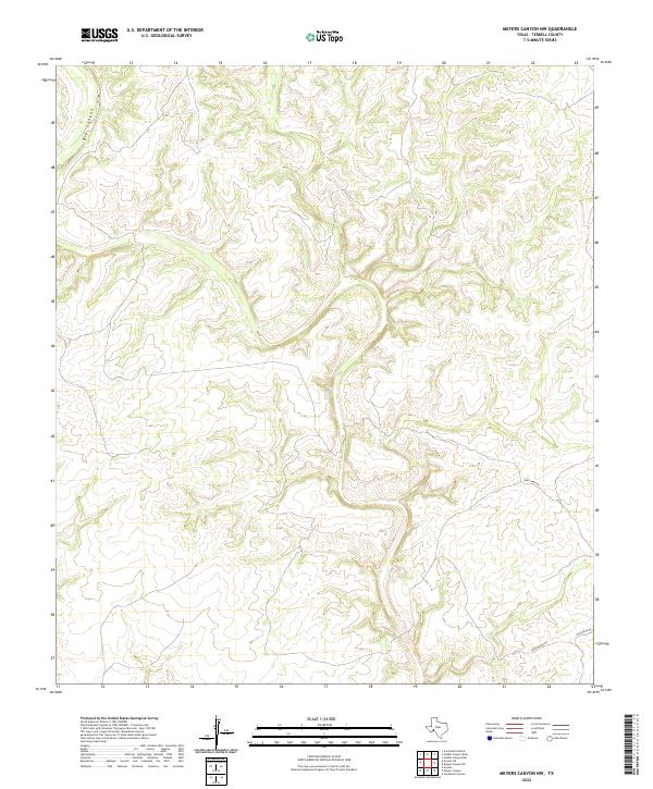
2022 Map of Meyers Canyon NW
USGS Topo · Published 2022About this map
Big Canyon dominates the northwestern portion of this remote segment of Terrell County, cutting through a landscape defined by sharp elevation changes and dry drainage patterns. This recent 2022 survey illustrates the sparse infrastructure characteristic of the Trans-Pecos region, where human presence is primarily marked by long-distance ranch roads. Transportation in this arid environment is limited to routes like Chriesman Rd and Hutchinson Rd, which wind through the complex topography to connect isolated outposts. The map provides a clear look at the modern drainage and contour data for these deep canyon systems, reflecting the unchanging nature of this rugged Texas borderland.
Find a feature on this map
3 named features on this map. Tap any name to fly to it.
Don’t see what you’re looking for? This feature index may not catch every label — zoom into the map to look around manually.
Map Details
Editions of this 2022 Meyers Canyon NW Map
This is the sole edition of this map. No revisions or reprints were ever made.
Other maps of this area

1928 · Sanderson
USGS Topo · 1:125,000

1954 · Fort Stockton
USGS Topo · 1:250,000

1954 · Sonora
USGS Topo · 1:250,000

1958 · Sonora
USGS Topo · 1:250,000

1958 · Fort Stockton
USGS Topo · 1:250,000

1968 · Dryden
USGS Topo · 1:24,000

1969 · Continental Ranch
USGS Topo · 1:24,000

1969 · Dryden NE
USGS Topo · 1:24,000

1973 · Fort Stockton
USGS Topo · 1:250,000
1980 · Geddis Canyon East
USGS Topo · 1:24,000