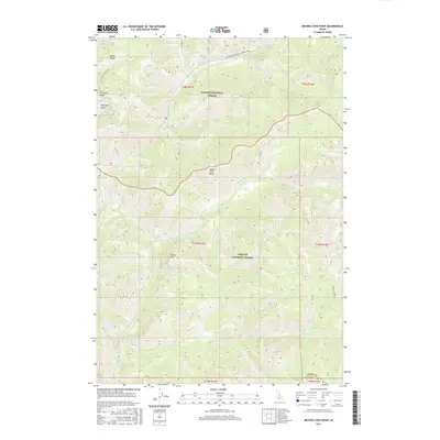
2017 Map of Meyers Cove Point
USGS Topo · Published 2017About this map
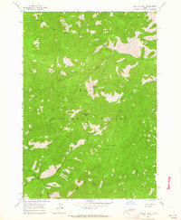
Fluorspar Ridge and the nearby Fluorspar Gulch highlight the industrial history of this mountain terrain on the border of Lemhi and Custer Counties. This 2017 survey shows the high-elevation landscape divided between the Salmon National Forest and Challis National Forest. Notable landmarks such as Meyers Cove Point and Castle Rock rise above a complex network of drainages including Silver Cr and Sawlog Cr. The only major route through this section of the Salmon River Mountains is the Meyers Cove Road (Winter Trail), which follows the path of Silver Cr as it winds through the northern sections. This map documents the remote drainage patterns and named peaks essential for navigating the backcountry of central Idaho, from Antler Ridge in the northwest to Furnace Creek in the southeast.
Find a feature on this map
27 named features on this map. Tap any name to fly to it.
Don’t see what you’re looking for? This feature index may not catch every label — zoom into the map to look around manually.
Map Details
Editions of this 2017 Meyers Cove Point Map
This is the sole edition of this map. No revisions or reprints were ever made.
Other maps of this area

1930 · Casto
USGS Topo · 1:125,000

1956 · Twin Peaks
USGS Topo · 1:62,500

1957 · Challis
USGS Topo · 1:250,000

1960 · Challis
USGS Topo · 1:250,000

1963 · Challis
USGS Topo · 1:250,000

1963 · Meyers Cove
USGS Topo · 1:24,000
1963 · Yellowjacket
USGS Topo · 1:24,000
1963 · Opal Lake
USGS Topo · 1:24,000
1963 · Duck Creek Point
USGS Topo · 1:24,000
1963 · Sheldon Peak
USGS Topo · 1:24,000