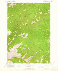
1963 Map of Yellowjacket
USGS Topo · Published 1964About this map
Yellowjacket Mine and a surrounding cluster of hard-rock workings like the Red Jacket Mine and Columbia Mine anchor this rugged section of the Idaho backcountry during the early 1960s. Located within the Salmon National Forest, the settlement at Yellowjacket is connected by a network of steep trails and primitive routes, including a Jeep Trail that winds through Van Horn Gulch. The concentration of mining activity, including the Tin Cup Mine and various prospects, suggests a landscape defined by mineral extraction and seasonal ranching at the nearby Yellowjacket Ranch.
Find a feature on this map
33 named features on this map. Tap any name to fly to it.
Don’t see what you’re looking for? This feature index may not catch every label — zoom into the map to look around manually.
Map Details
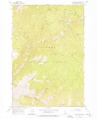
Editions of this 1963 Yellowjacket Map
2 editions found
Other maps of this area

1930 · Casto
USGS Topo · 1:125,000

1950 · Blackbird Mtn
USGS Topo · 1:62,500

1951 · Blackbird Mtn
USGS Topo · 1:62,500

1956 · Elk City
USGS Topo · 1:250,000

1957 · Challis
USGS Topo · 1:250,000

1960 · Elk City
USGS Topo · 1:250,000

1960 · Challis
USGS Topo · 1:250,000

1962 · Hoodoo Meadows
USGS Topo · 1:24,000

1962 · Puddin Mtn
USGS Topo · 1:24,000

1963 · Challis
USGS Topo · 1:250,000