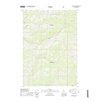
2020 Map of Meyers Cove Point
USGS Topo · Published 2020About this map
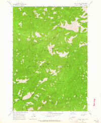
Meyers Cove sits at the intersection of several seasonal transit routes and deep drainage systems within the central Idaho mountains. This 2020 map documents a landscape where mining history and forest management converge, most notably at Fluorspar Ridge and Fluorspar Gulch, indicating the area's geological significance for mineral extraction. The map illustrates a complex network of watercourses including Silver Creek and Camas Creek, which carve through the high elevations of the Salmon National Forest and Challis National Forest. Distinctive landmarks such as Meyers Cove Point, Antler Ridge, and Castle Rock dominate the terrain, while the Meyers Cove Road provides a critical winter transit route through the high country. The cartography provides a clear picture of the boundary lines between the national forests and the township and range divisions that define this part of Lemhi County.
Find a feature on this map
32 named features on this map. Tap any name to fly to it.
Don’t see what you’re looking for? This feature index may not catch every label — zoom into the map to look around manually.
Map Details
Editions of this 2020 Meyers Cove Point Map
This is the sole edition of this map. No revisions or reprints were ever made.
Other maps of this area

1930 · Casto
USGS Topo · 1:125,000

1956 · Twin Peaks
USGS Topo · 1:62,500

1957 · Challis
USGS Topo · 1:250,000

1960 · Challis
USGS Topo · 1:250,000

1963 · Challis
USGS Topo · 1:250,000

1963 · Meyers Cove
USGS Topo · 1:24,000
1963 · Yellowjacket
USGS Topo · 1:24,000
1963 · Opal Lake
USGS Topo · 1:24,000
1963 · Duck Creek Point
USGS Topo · 1:24,000
1963 · Sheldon Peak
USGS Topo · 1:24,000