
1963 Map of Meyersville
USGS Topo · Published 1965About this map
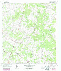
Meyersville and its neighbor Upper Meyersville anchor this 1963 survey of the South Texas prairie near the De Witt and Goliad County line. The landscape is a distinct mix of agricultural tradition and mid-century industrial development, where quiet landmarks like St Johns Ch, St Peter and Pauls Ch, and the De Witt Sch stand alongside the sprawling Arneckeville Gas Field and Meyersville Gas Field.
Find a feature on this map
25 named features on this map. Tap any name to fly to it.
Don’t see what you’re looking for? This feature index may not catch every label — zoom into the map to look around manually.
Map Details
Editions of this 1963 Meyersville Map
2 editions found
Other maps of this area

1953 · Beeville
USGS Topo · 1:250,000

1953 · Seguin
USGS Topo · 1:250,000

1956 · Beeville
USGS Topo · 1:250,000

1958 · Seguin
USGS Topo · 1:250,000

1960 · Beeville
USGS Topo · 1:250,000

1960 · Cuero
USGS Topo · 1:24,000

1960 · Blackwell Lake
USGS Topo · 1:24,000

1962 · Verhelle
USGS Topo · 1:24,000

1963 · Weesatche
USGS Topo · 1:24,000
1963 · Yorktown East
USGS Topo · 1:24,000