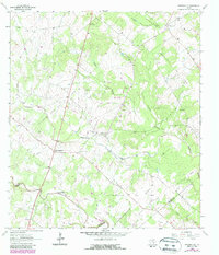
1963 Map of Meyersville
USGS Topo · Published 1987About this map
Twelvemile Creek and its many tributaries, including Hog Branch and Boggy Branch, define the rural landscape of south-central Texas in this mid-1960s survey. The area is characterized by scattered settlements and localized energy production, notably the Arneckeville Gas Field and Meyersville Gas Field. Community life centers on the villages of Meyersville, Upper Meyersville, and Arneckeville, where historical landmarks such as St Johns Ch and St Peter and Pauls Ch are located. For genealogists, the map identifies specific local institutions like De Witt Sch and the St Joseph Cem. The presence of numerous Gravel Pits and various oil fields throughout the basin highlights the extractive industries that shaped the local economy alongside traditional agriculture. This edition, revised in the early 1980s, captures the persisting rural character as the county lines of De Witt, Goliad, and Victoria converge.
Find a feature on this map
24 named features on this map. Tap any name to fly to it.
Don’t see what you’re looking for? This feature index may not catch every label — zoom into the map to look around manually.
Map Details
Editions of this 1963 Meyersville Map
2 editions found
Other maps of this area

1953 · Beeville
USGS Topo · 1:250,000

1953 · Seguin
USGS Topo · 1:250,000

1956 · Beeville
USGS Topo · 1:250,000

1958 · Seguin
USGS Topo · 1:250,000

1960 · Beeville
USGS Topo · 1:250,000

1960 · Cuero
USGS Topo · 1:24,000

1960 · Blackwell Lake
USGS Topo · 1:24,000

1962 · Verhelle
USGS Topo · 1:24,000

1963 · Meyersville
USGS Topo · 1:24,000

1963 · Weesatche
USGS Topo · 1:24,000