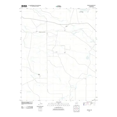
2010 Map of Miami NE
USGS Topo · Published 2010About this map
The Cimarron River winds through this Colfax County landscape, serving as a primary waterway for agricultural operations in the high plains. Large ranching and farming tracts define the land use, represented by named properties such as McDaniel Cimarron Place, Urraca Place, and the C S Ranch. This 2010 survey illustrates the irrigation infrastructure essential to the region, most notably the Springer Ditch and the Antelope Valley Reservoir Number Two with its associated Antelope Valley Number 2 Reservoir Dam.
Find a feature on this map
22 named features on this map. Tap any name to fly to it.
Don’t see what you’re looking for? This feature index may not catch every label — zoom into the map to look around manually.
Map Details
Editions of this 2010 Miami NE Map
This is the sole edition of this map. No revisions or reprints were ever made.
Other maps of this area

1915 · Koehler
USGS Topo · 1:62,500

1917 · Koehler
USGS Topo · 1:62,500

1954 · Raton
USGS Topo · 1:250,000

1955 · Cimarron
USGS Topo · 1:62,500

1956 · Miami
USGS Topo · 1:62,500

1958 · Raton
USGS Topo · 1:250,000

1964 · Pinon Hills
USGS Topo · 1:24,000

1965 · Springer Lake
USGS Topo · 1:24,000
1971 · Colfax
USGS Topo · 1:24,000

1981 · Springer
USGS Topo · 1:100,000