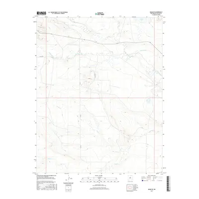
2017 Map of Miami NE
USGS Topo · Published 2017About this map
Cimarron River and its various tributaries define the hydrological character of this portion of Colfax County. The landscape is marked by a network of drainage systems, including Ponil Cr in the north and the meandering Rayado Cr and Urraca Cr further south. These watercourses are vital to the local geography, supplemented by man-made infrastructure like the Springer Ditch and Number 2 Lake, which indicate the importance of water management in this high-plains environment. Roadways such as Deer Run Rd and Co Rd 12 provide access through the undulating terrain, connecting rural parcels and following the natural contours shaped by Chicoso Cr. The presence of these named roads and water features provides a clear view of the rural development and topographic layout of the region during this contemporary period.
Find a feature on this map
11 named features on this map. Tap any name to fly to it.
Don’t see what you’re looking for? This feature index may not catch every label — zoom into the map to look around manually.
Map Details
Editions of this 2017 Miami NE Map
This is the sole edition of this map. No revisions or reprints were ever made.
Other maps of this area

1915 · Koehler
USGS Topo · 1:62,500

1917 · Koehler
USGS Topo · 1:62,500

1954 · Raton
USGS Topo · 1:250,000

1955 · Cimarron
USGS Topo · 1:62,500

1956 · Miami
USGS Topo · 1:62,500

1958 · Raton
USGS Topo · 1:250,000

1964 · Pinon Hills
USGS Topo · 1:24,000

1965 · Springer Lake
USGS Topo · 1:24,000
1971 · Colfax
USGS Topo · 1:24,000

1981 · Springer
USGS Topo · 1:100,000