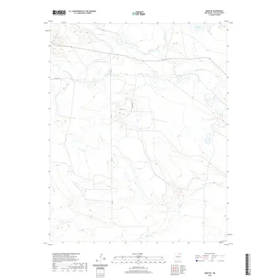
2020 Map of Miami NE
USGS Topo · Published 2020About this map
Cimarron River and its multiple tributaries define this section of Colfax County, where high-desert drainage patterns dictate the local infrastructure. The landscape is marked by a complex network of seasonal and perennial waterways including Ponil Cr in the north and Rayado Cr in the south, reflecting a terrain managed for water distribution. Human activity is evidenced by the Springer Ditch and the presence of Number Two Lake, highlighting the critical role of irrigation and water storage in this arid environment. Transportation is limited to a sparse grid of rural routes such as Co Rd 12 and Deer Run Rd, which navigate the various draws and creek beds. The drainage systems of Urraca Cr and Chicoso Cr reveal the natural topography that shaped early ranching and land use in this part of New Mexico.
Find a feature on this map
12 named features on this map. Tap any name to fly to it.
Don’t see what you’re looking for? This feature index may not catch every label — zoom into the map to look around manually.
Map Details
Editions of this 2020 Miami NE Map
This is the sole edition of this map. No revisions or reprints were ever made.
Other maps of this area

1915 · Koehler
USGS Topo · 1:62,500

1917 · Koehler
USGS Topo · 1:62,500

1954 · Raton
USGS Topo · 1:250,000

1955 · Cimarron
USGS Topo · 1:62,500

1956 · Miami
USGS Topo · 1:62,500

1958 · Raton
USGS Topo · 1:250,000

1964 · Pinon Hills
USGS Topo · 1:24,000

1965 · Springer Lake
USGS Topo · 1:24,000
1971 · Colfax
USGS Topo · 1:24,000

1981 · Springer
USGS Topo · 1:100,000