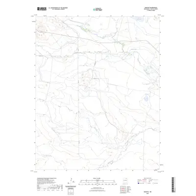
2023 Map of Miami NE
USGS Topo · Published 2023About this map
The Cimarron River and its network of tributaries define this Colfax County landscape, where the high plains meet the transition to more varied terrain. In this contemporary survey, the intricate drainage patterns of Rayado Creek and Urraca Creek carve through the southern portion of the sheet, while Ponil Creek and its tributary, Cerrososo Creek, dominate the north. The presence of the Springer Ditch and the reservoir at Number Two Lake points to a sophisticated water management system vital for ranching or agriculture in this arid region. Although the area is lightly settled, rural corridors like Horseshoe Rd and Deer Run Rd provide access through the valley systems that have historically shaped movement and land use in this part of New Mexico.
Find a feature on this map
12 named features on this map. Tap any name to fly to it.
Don’t see what you’re looking for? This feature index may not catch every label — zoom into the map to look around manually.
Map Details
Editions of this 2023 Miami NE Map
This is the sole edition of this map. No revisions or reprints were ever made.
Other maps of this area

1915 · Koehler
USGS Topo · 1:62,500

1917 · Koehler
USGS Topo · 1:62,500

1954 · Raton
USGS Topo · 1:250,000

1955 · Cimarron
USGS Topo · 1:62,500

1956 · Miami
USGS Topo · 1:62,500

1958 · Raton
USGS Topo · 1:250,000

1964 · Pinon Hills
USGS Topo · 1:24,000

1965 · Springer Lake
USGS Topo · 1:24,000
1971 · Colfax
USGS Topo · 1:24,000

1981 · Springer
USGS Topo · 1:100,000