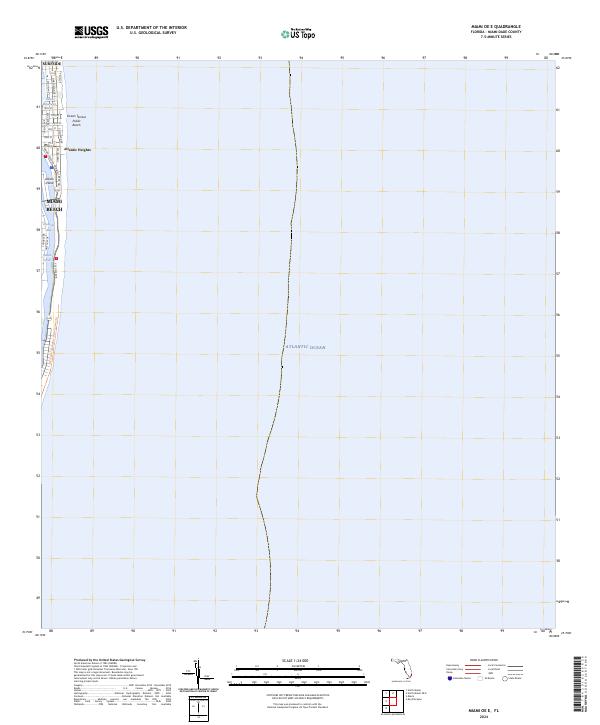
2024 Map of Miami OE E
USGS Topo · Published 2024About this map
Miami Beach and Surfside anchor the narrow barrier island depicted here, where urban development meets the vast Atlantic Ocean. The coastal landscape is defined by its waterways, including the Tatum Waterway and the winding course of Indian Creek, which separates the primary island from the residential layout of Allison Island. This 2024 survey documents the dense street grid characteristic of the region, featuring major thoroughfares like Collins Ave and Harding Ave that parallel the shoreline. Public spaces such as Ocean Terrace Public Beach are prominent along the eastern edge, while the western side of the island overlooks the waters of Biscayne Bay. Modern infrastructure is represented by the East Coast Greenway - Dade Corridor Trl, showing how transportation and recreation corridors have been integrated into this established beachfront environment.
Find a feature on this map
25 named features on this map. Tap any name to fly to it.
Don’t see what you’re looking for? This feature index may not catch every label — zoom into the map to look around manually.
Map Details
Editions of this 2024 Miami OE E Map
This is the sole edition of this map. No revisions or reprints were ever made.
Other maps of this area

1947 · North Miami
USGS Topo · 1:24,000

1947 · Key Biscayne
USGS Topo · 1:24,000

1949 · Key Biscayne
USGS Topo · 1:24,000

1950 · Miami
USGS Topo · 1:24,000

1950 · North Miami
USGS Topo · 1:24,000

1956 · Miami
USGS Topo · 1:250,000

1958 · Miami
USGS Topo · 1:250,000
1962 · Miami
USGS Topo · 1:24,000
1962 · Key Biscayne
USGS Topo · 1:24,000
1962 · North Miami
USGS Topo · 1:24,000