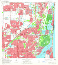
1962 Map of North Miami
USGS Topo · Published 1965About this map
The coastal and inland development of northern Miami-Dade County is captured here at a point of rapid mid-century expansion. The landscape is defined by the engineered waterways of the Intracoastal Waterway, Dumfoundling Bay, and the Oleta River, which contrast with the growing residential grids of North Miami Beach, Opa-locka, and Miramar. Significant infrastructure projects like the Sunshine State Parkway and Palmetto Expressway facilitate movement through these suburban reaches, while the Florida East Coast Railway and Seaboard Air Line Railroad provide older transit corridors.
Find a feature on this map
139 named features on this map. Tap any name to fly to it.
Don’t see what you’re looking for? This feature index may not catch every label — zoom into the map to look around manually.
Map Details
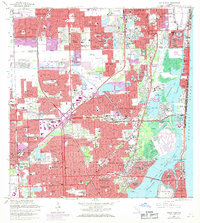
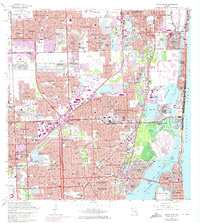
Editions of this 1962 North Miami Map
3 editions found
Other maps of this area

1947 · North Miami
USGS Topo · 1:24,000

1949 · Opalocka
USGS Topo · 1:24,000

1949 · Port Everglades
USGS Topo · 1:24,000

1949 · Fort Lauderdale South
USGS Topo · 1:24,000

1950 · Hialeah
USGS Topo · 1:24,000

1950 · Miami
USGS Topo · 1:24,000

1950 · North Miami
USGS Topo · 1:24,000

1956 · Miami
USGS Topo · 1:250,000

1956 · West Palm Beach
USGS Topo · 1:250,000

1957 · West Palm Beach
USGS Topo · 1:250,000