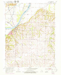
1951 Map of Miami
USGS Topo · Published 1979About this map
The Missouri River defines the landscape of this 1951 survey, where it divides Carroll and Saline Counties near the settlement of Miami. The map captures a complex hydrological network including Wakenda Chute and the engineered Van Meter Ditch, reflecting the ongoing management of the fertile river bottomlands. This area is characterized by a mix of flat alluvial plains to the north and dissected upland terrain to the south, where small communities and rural institutions once thrived. Local genealogy is anchored by landmarks such as Christian Cem, Township Sch, and several rural houses of worship including Harmony Ch and Shilo Ch. The presence of the Wabash railroad line along the northern bank underscores the importance of rail transport to the agricultural economy of the mid-20th century, connecting these riverside outposts to wider markets.
Find a feature on this map
21 named features on this map. Tap any name to fly to it.
Don’t see what you’re looking for? This feature index may not catch every label — zoom into the map to look around manually.
Map Details
Editions of this 1951 Miami Map
2 editions found
Other maps of this area

1890 · Marshall
USGS Topo · 1:125,000

1892 · Marshall
USGS Topo · 1:125,000

1901 · Marshall
USGS Topo · 1:125,000

1940 · Marshall
USGS Topo · 1:62,500

1944 · Marshall
USGS Topo · 1:62,500

1951 · Bosworth
USGS Topo · 1:24,000

1951 · Miami
USGS Topo · 1:24,000

1951 · Brunswick West
USGS Topo · 1:24,000

1951 · Miami Station
USGS Topo · 1:24,000

1951 · Brunswick East
USGS Topo · 1:24,000