
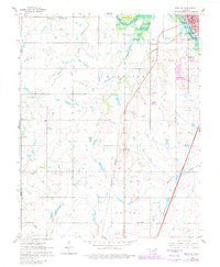
1961 Map of Miami SW
USGS Topo · Published 1963About this map
The St Louis San Francisco railroad and the Will Rogers Turnpike cut diagonally across this landscape, illustrating the evolution of Oklahoma transportation routes in the mid-twentieth century. Near the northeastern corner, the Neosho River flows into the Lake O' the Cherokees, where the Peoria Indian Reservation Bdy meets the water. The settlement of Narcissa serves as a central landmark alongside the rail line, while the fringe of Miami appears in the northeast. Genealogy researchers will find several rural institutions well-preserved, including Lone Star Ch, Mound Valley Ch, and its neighboring Mound Valley Sch. The map also captures the local educational landscape with Lincoln Sch and Sacred Heart Sch, alongside the Coal Creek Cem and a County Home near the gravel operations.
Find a feature on this map
30 named features on this map. Tap any name to fly to it.
Don’t see what you’re looking for? This feature index may not catch every label — zoom into the map to look around manually.
Map Details
Editions of this 1961 Miami SW Map
2 editions found
Other maps of this area

1901 · Vinita
USGS Topo · 1:125,000

1907 · Wyandotte
USGS Topo · 1:125,000

1909 · Wyandotte
USGS Topo · 1:125,000

1913 · Vinita
USGS Topo · 1:125,000

1954 · Tulsa
USGS Topo · 1:250,000

1958 · Tulsa
USGS Topo · 1:250,000

1961 · Miami SE
USGS Topo · 1:24,000
1961 · Miami NW
USGS Topo · 1:24,000
1961 · Picher
USGS Topo · 1:24,000

1963 · Tulsa
USGS Topo · 1:250,000