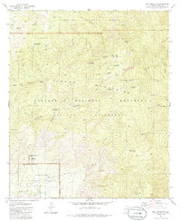
1981 Map of Mica Mountain
USGS Topo · Published 1981About this map
Mica Mountain rises as the central landmark of this 1981 survey, where the protected lands of Saguaro National Monument and the Coronado National Forest converge. The landscape is defined by its network of canyons and high-altitude features like Mica Meadow and Helens Dome. Human presence in this environment is represented by remote outposts such as Manning Camp and the Madrona Ranger Sta, alongside legacy locations like the Spud Rock Cabin (Site).
Find a feature on this map
46 named features on this map. Tap any name to fly to it.
Don’t see what you’re looking for? This feature index may not catch every label — zoom into the map to look around manually.
Map Details
Editions of this 1981 Mica Mountain Map
3 editions found
Other maps of this area

1904 · Tucson
USGS Topo · 1:125,000

1905 · Tucson
USGS Topo · 1:125,000

1945 · Redington
USGS Topo · 1:62,500

1945 · Happy Valley
USGS Topo · 1:62,500

1956 · Tucson
USGS Topo · 1:250,000

1957 · Bellota Ranch
USGS Topo · 1:62,500

1957 · Rincon Valley
USGS Topo · 1:62,500

1957 · Redington
USGS Topo · 1:62,500

1958 · Tucson
USGS Topo · 1:250,000

1958 · Happy Valley
USGS Topo · 1:62,500