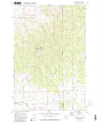
1973 Map of Mica Peak
USGS Topo · Published 1982About this map
The Mica Peak Air Force Station commands the highest elevation in this 1970s survey, marking a significant military presence along the Washington-Idaho state line. This high-altitude installation, supported by several Radio Towers and a dedicated Radio Facility, overlooks a landscape defined by steep drainages and the expansive Liberty Lake Regional Park. The southern portion of the map reveals the region's transport and burial history, with the Mica Peak Cem and Mica Creek Cem located near the former routes of the Chicago Milwaukee St Paul and Pacific Railroad and the Union Pacific Railroad. An Old Railroad Grade further suggests the evolution of local infrastructure near the settlement of Manito. The eastern boundary is defined by the Spokane and Kootenai county line, while the southern reaches include a portion of the Indian Reservation Boundary.
Find a feature on this map
48 named features on this map. Tap any name to fly to it.
Don’t see what you’re looking for? This feature index may not catch every label — zoom into the map to look around manually.
Map Details
Editions of this 1973 Mica Peak Map
3 editions found
Other maps of this area

1901 · Spokane
USGS Topo · 1:125,000

1903 · Oakesdale
USGS Topo · 1:125,000

1903 · Rathdrum
USGS Topo · 1:125,000

1905 · Oakesdale
USGS Topo · 1:125,000

1949 · Greenacres
USGS Topo · 1:62,500

1951 · Greenacres
USGS Topo · 1:62,500

1954 · Fairfield
USGS Topo · 1:62,500

1955 · Spokane
USGS Topo · 1:250,000

1957 · Plummer
USGS Topo · 1:62,500

1957 · Coeur D'Alene
USGS Topo · 1:62,500