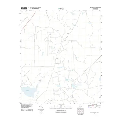
2011 Map of Miccosukee NE
USGS Topo · Published 2011About this map
Foshalee Lake dominates the southwestern quadrant of this landscape along the Georgia-Florida border, where a network of family-named cemeteries and vast agricultural holdings define the local geography. The map reveals a transition from traditional plantation lands like Borderline Plantation and Springhill Plantation to established estates such as Wendy Wood Farms. Small, localized water bodies including Gin House Pond, Original Pond, and Murray Pond are scattered across the terrain, connected by seasonal drainages like Dry Creek and Titi Branch. This 2011 survey serves as a vital record for genealogists, preserving the locations of several burial grounds including Blalock Cemetery, Spring Hill Cemetery, and Copeland Cemetery. The road network, featuring routes like Old Centerville Rd and Veterans Memorial Dr, reflects the area's continued use as a center for timber and agriculture.
Find a feature on this map
35 named features on this map. Tap any name to fly to it.
Don’t see what you’re looking for? This feature index may not catch every label — zoom into the map to look around manually.
Map Details
Editions of this 2011 Miccosukee NE Map
This is the sole edition of this map. No revisions or reprints were ever made.
Other maps of this area

1954 · Valdosta
USGS Topo · 1:250,000

1954 · Tallahassee
USGS Topo · 1:250,000

1956 · Cairo
USGS Topo · 1:62,500

1956 · Metcalf
USGS Topo · 1:24,000

1957 · Beachton
USGS Topo · 1:24,000

1957 · Miccosukee NE
USGS Topo · 1:24,000

1957 · Thomasville
USGS Topo · 1:62,500

1958 · Valdosta
USGS Topo · 1:250,000

1959 · Tallahassee
USGS Topo · 1:250,000

1959 · Valdosta
USGS Topo · 1:250,000