2000 Map of Michigan Bluff
USGS Topo · Published 2003About this map
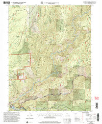
Michigan Bluff sits high above the deep canyons of the Middle Fork American River in this survey of California's Gold Country. The landscape is a complex record of hydraulic and lode mining, dominated by the massive Big Gun Diggings just east of the main settlement. Further south, the Ralston Afterbay Reservoir marks the confluence of the river's forks, while the Foresthill Divide Road follows the ridgeline through the Tahoe National Forest.
Find a feature on this map
124 named features on this map. Tap any name to fly to it.
Don’t see what you’re looking for? This feature index may not catch every label — zoom into the map to look around manually.
Map Details
Editions of this 2000 Michigan Bluff Map
2 editions found

Other maps of this area

1891 · Colfax
USGS Topo · 1:125,000

1891 · Placerville
USGS Topo · 1:125,000

1892 · Placerville
USGS Topo · 1:125,000

1892 · Colfax
USGS Topo · 1:125,000

1893 · Placerville
USGS Topo · 1:125,000

1894 · Colfax
USGS Topo · 1:125,000

1898 · Colfax
USGS Topo · 1:125,000

1900 · Colfax
USGS Topo · 1:125,000

1902 · Colfax
USGS Topo · 1:125,000

1938 · Colfax
USGS Topo · 1:125,000