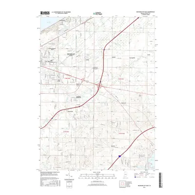
2016 Map of Michigan City East
USGS Topo · Published 2016About this map
The southern shoreline of Lake Michigan meets a network of inland drainage ditches and residential growth in this 2016 survey of Michigan City. The map reveals a complex landscape of coastal communities like Long Beach and Pottawattomie Park transitioning into more rural pockets such as Springfield and Summit. Inland, the terrain is defined by engineered waterways like Beck Ditch and White Ditch, which crisscross the low-lying areas between small lakes including Ohms Lake and Dingler Lake.
Find a feature on this map
158 named features on this map. Tap any name to fly to it.
Don’t see what you’re looking for? This feature index may not catch every label — zoom into the map to look around manually.
Map Details
Editions of this 2016 Michigan City East Map
This is the sole edition of this map. No revisions or reprints were ever made.
Other maps of this area

1930 · Three Oaks
USGS Topo · 1:62,500

1944 · Three Oaks
USGS Topo · 1:62,500

1953 · Westville
USGS Topo · 1:24,000

1953 · Michigan City West
USGS Topo · 1:24,000

1953 · Chicago
USGS Topo · 1:250,000

1957 · Chicago
USGS Topo · 1:250,000

1958 · Michigan City East
USGS Topo · 1:24,000

1958 · La Porte East
USGS Topo · 1:24,000

1958 · Springville
USGS Topo · 1:24,000
1961 · La Porte West
USGS Topo · 1:24,000