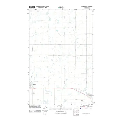
2011 Map of Michigan East
USGS Topo · Published 2011About this map
Michigan and Petersburg anchor the southern portion of this eastern Nelson County landscape, connected by the central corridor of 42nd St NE. The area is defined by a high density of prairie potholes and small wetlands, which pepper the township sections between the rigid grid of county roads. To the north, Lake Miller stands out as a prominent water body, while the rural terrain is marked by the Senator Young Dam further east. For those researching local family history, the Michigan Cemetery is clearly plotted just south of the main settlement. The map reflects a modern rural environment where historic town centers like Michigan remain the primary hubs of activity, surrounded by an extensive network of range and township lines such as 116th Ave NE and County Rd 11.
Find a feature on this map
31 named features on this map. Tap any name to fly to it.
Don’t see what you’re looking for? This feature index may not catch every label — zoom into the map to look around manually.
Map Details
Editions of this 2011 Michigan East Map
This is the sole edition of this map. No revisions or reprints were ever made.
Other maps of this area

1939 · Niagara
USGS Topo · 1:62,500

1942 · McVille
USGS Topo · 1:62,500

1952 · Grand Forks
USGS Topo · 1:250,000

1952 · Thief River Falls
USGS Topo · 1:250,000

1952 · New Rockford
USGS Topo · 1:250,000

1953 · Devils Lake
USGS Topo · 1:250,000

1956 · New Rockford
USGS Topo · 1:250,000

1956 · Thief River Falls
USGS Topo · 1:250,000

1956 · Devils Lake
USGS Topo · 1:250,000

1956 · Grand Forks
USGS Topo · 1:250,000