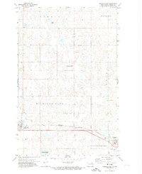
1971 Map of Michigan East
USGS Topo · Published 1974About this map
Michigan and Petersburg anchor this segment of Nelson County, where the plains are defined by a complex network of wetlands and agricultural tracts. This 1971 survey captures the area just as the Northern railroad line provided the primary east-west corridor through the townships of Sarnia, Dahlen, and Nash. The landscape is dotted with numerous small basins, several of which are designated as a National Waterfowl Production Area, reflecting the region's importance for migratory birds. Evidence of local infrastructure and community life is visible through the presence of the Michigan Cemetery, another smaller Cemetery to the north, and scattered Gravel Pits used for road maintenance. This sheet offers a clear look at the rural section lines and field boundaries that organized North Dakota farming life in the early 1970s.
Find a feature on this map
16 named features on this map. Tap any name to fly to it.
Don’t see what you’re looking for? This feature index may not catch every label — zoom into the map to look around manually.
Map Details
Editions of this 1971 Michigan East Map
This is the sole edition of this map. No revisions or reprints were ever made.
Other maps of this area

1939 · Niagara
USGS Topo · 1:62,500

1942 · McVille
USGS Topo · 1:62,500

1952 · Grand Forks
USGS Topo · 1:250,000

1952 · Thief River Falls
USGS Topo · 1:250,000

1952 · New Rockford
USGS Topo · 1:250,000

1953 · Devils Lake
USGS Topo · 1:250,000

1956 · New Rockford
USGS Topo · 1:250,000

1956 · Thief River Falls
USGS Topo · 1:250,000

1956 · Devils Lake
USGS Topo · 1:250,000

1956 · Grand Forks
USGS Topo · 1:250,000