
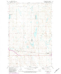
1971 Map of Michigan West
USGS Topo · Published 1974About this map
Michigan (Michigan City) and the small settlement of Mapes serve as the primary hubs on this prairie landscape, positioned along the Burlington Northern railroad corridor. The area is characterized by an extensive network of wetlands and glacial lakes, including Lake Laretta, Lake Mary, and Rose Lake, which dominate the central terrain. These water bodies are often surrounded by protected wildlife habitats, such as the National Waterfowl Production Area, highlighting the region's importance for migratory bird conservation. The township boundaries of Enterprise, Sarnia, Rubin, Michigan City, and Williams provide a clear genealogical framework for the rural homesteads and section lines. Local infrastructure is reflected in smaller details like Wright Field and various gravel pits, which point to the local aviation and road-building needs of this Nelson County community during the early 1970s.
Find a feature on this map
16 named features on this map. Tap any name to fly to it.
Don’t see what you’re looking for? This feature index may not catch every label — zoom into the map to look around manually.
Map Details
Editions of this 1971 Michigan West Map
2 editions found
Other maps of this area

1930 · Pekin
USGS Topo · 1:62,500

1942 · McVille
USGS Topo · 1:62,500

1951 · Pekin NE
USGS Topo · 1:24,000

1951 · Pekin
USGS Topo · 1:62,500

1952 · New Rockford
USGS Topo · 1:250,000

1953 · Devils Lake
USGS Topo · 1:250,000

1956 · New Rockford
USGS Topo · 1:250,000

1956 · Devils Lake
USGS Topo · 1:250,000

1970 · Lakota
USGS Topo · 1:24,000
1971 · Michigan East
USGS Topo · 1:24,000