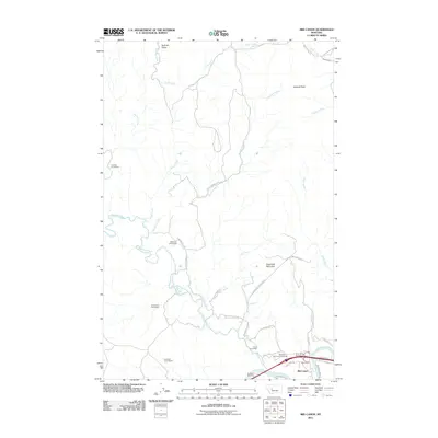
2011 Map of Mid Canon
USGS Topo · Published 2011About this map
Mid Canon sits at the confluence of the Dearborn River and the Missouri River, anchoring a landscape defined by ranching history and river travel. This 2011 survey illustrates the distribution of historic family legacy sites throughout the river valley, including the Lesofski Homestead, McKinzter Homestead, and Timberman Homestead. The terrain rises sharply from the water towards prominent peaks like Sawmill Peak and Sugarloaf Mountain, creating a corridor for modern infrastructure such as Old US Highway 91. The presence of the Dearborn Vol Fire Company and the Dearborn Rest Area near the river bank highlights the area's continued importance as a transit point between the northern plains and the mountain foothills. Local geography is further detailed by numerous drainages, including Sullivan Creek, Sheep Creek, and Trout Creek, which carve through the high ground of Sullivan Valley.
Find a feature on this map
35 named features on this map. Tap any name to fly to it.
Don’t see what you’re looking for? This feature index may not catch every label — zoom into the map to look around manually.
Map Details
Editions of this 2011 Mid Canon Map
This is the sole edition of this map. No revisions or reprints were ever made.
Other maps of this area

1886 · Great Falls
USGS Topo · 1:250,000

1943 · Hogan
USGS Topo · 1:125,000

1954 · Great Falls
USGS Topo · 1:250,000

1955 · Choteau
USGS Topo · 1:250,000

1957 · Choteau
USGS Topo · 1:250,000

1957 · Great Falls
USGS Topo · 1:250,000

1958 · Choteau
USGS Topo · 1:250,000

1960 · Simms
USGS Topo · 1:62,500

1961 · Craig
USGS Topo · 1:24,000

1961 · Hardy
USGS Topo · 1:24,000